Rivers Feed the Trees

Meredith Nemirov | January 6, 2022 | Leave a Comment

Rivers Feed The Trees #470, 2021, Acrylagouache On Historic Topographic Map, 13.5” X 17” (detail)

“To put your hands in a river is to feel the chords that bind the earth together.” Barry Lopez

On-Site River Study, San Miguel River, Colorado 6/13/2021, Watercolor, 5” X 8”

Rivers Feed the Trees is a series of works on paper addressing the issue of climate change specifically regarding water in the West and Southwestern United States. The summer of 2020 was one of the extreme wildfires that created a figurative conflagration in my studio which resulted in this series representing a “re-watering” of the landscape. 

Rivers Feed The Trees #454, 2021, acrylagouache on a historic topographic map, 13.5” x 17”

The months leading up to that summer of 2020 when we were all in Covid19 lockdown were not a particularly fruitful time in the studio. Our plans to relocate to Europe along with teaching an annual painting workshop in Spain and a residency in Ireland were canceled. But greater than that disappointment was our concern for friends and family in Spain, Italy, China, and New York City.  

As we adjusted to life in lockdown with our ability to travel restricted we started walking around the block and experiencing our local neighborhoods in a more intimate way.  I was very fortunate to live in a small town with a natural environment right outside my door. My daily walks down to the river were surrounded by the trees that I have drawn for the past 30 years.  

Like many other artists, I found it difficult to concentrate. When I was in the studio I  started organizing my flat files filled with older work, drawing papers, and prints.  I found some maps of Colorado that were leftover from when we had an antique print,  map, and book gallery 20 years ago that specialized in the exploration of the American  West. I remembered that I had been captivated by the abstract quality of some of the large folio-size topographic maps from the Hayden Survey of 1877. In the gallery, we would pour over the maps recognizing the names of places we looked at every day. A  map from long ago remained so much a representation of our local environment today.  

1877 Hayden Survey Map Sheet Iv Of Geological And Geographical Atlas Of Colorado 

The linear elements and patterns assigned by those cartographers to the various aspects of the geology have been a big influence on my drawings and paintings of the aspen trees which have been the focus of my work for the past 30 years. I drew the topography into the trees and enjoyed the trees becoming a part of the land.  

Winter Woods One, 2019, Watercolor, Ink And Gouache On Paper, 18” X 24”

Snowpack, snowmelt, runoff, snowshed, snow cover, snow density, snowdrift. These words were not part of my vocabulary or consciousness before I moved from  New York City to Colorado. It took me years to understand that snow was not the enemy that made driving more dangerous and walking on snow-covered icy streets risky. That we desperately needed the snowpack that created the snowmelt that turned into runoff into our rivers and…there was the key, the confluence that would connect the rivers with their tributaries with the topography of the land and the land with the trees! This was the inception of Rivers Feed the Trees.

Rivers Feed The Trees #463 And #458, 2020, Acrylagouache On Historic Topographic Maps, 13.5” X 17” 

After I moved to southwest Colorado in 1988, I started to learn about the Native  American tribes living in the four corners area where Utah, Arizona, New Mexico, and  Colorado meet. I learned more about these indigenous people through the antique prints we exhibited in our gallery. There were many that depicted the dances; the Sun  Dance of the Lakota Sioux, the Snake Dance of the Hopi tribe next door in Arizona, and the Bear Dance of the Ute Indians who lived in the Uncompahgre Valley, the place I now called home.  

Colorado is no stranger to prolonged periods of drought. When we arrived it was at the end of the fourth drought cycle of the 20th century that started in the 1970s. When we displayed Frederic Remington’s print “The Drought in the Southwest” in our front window, we watched as local ranchers stared at it with anxious looks on their faces.  

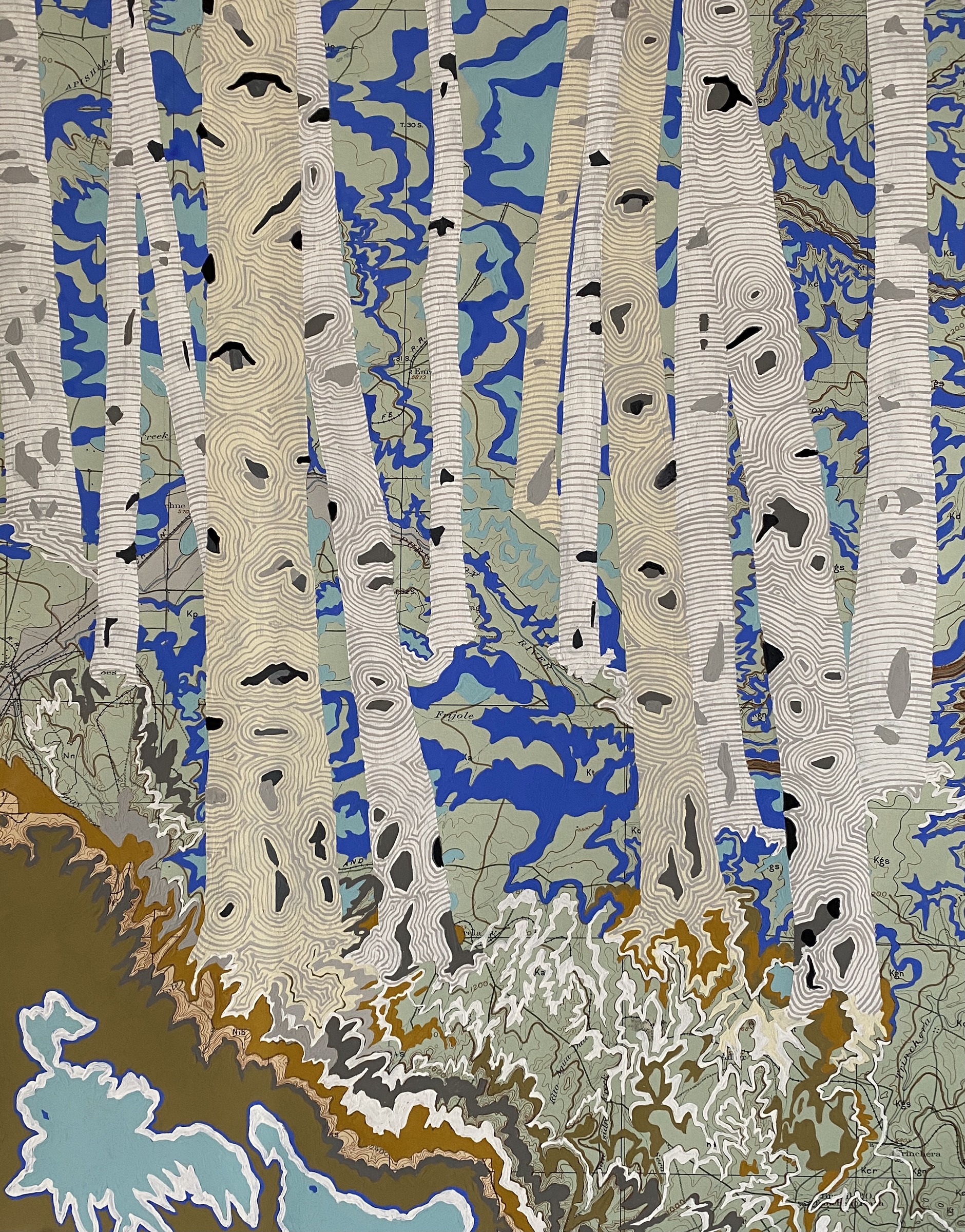
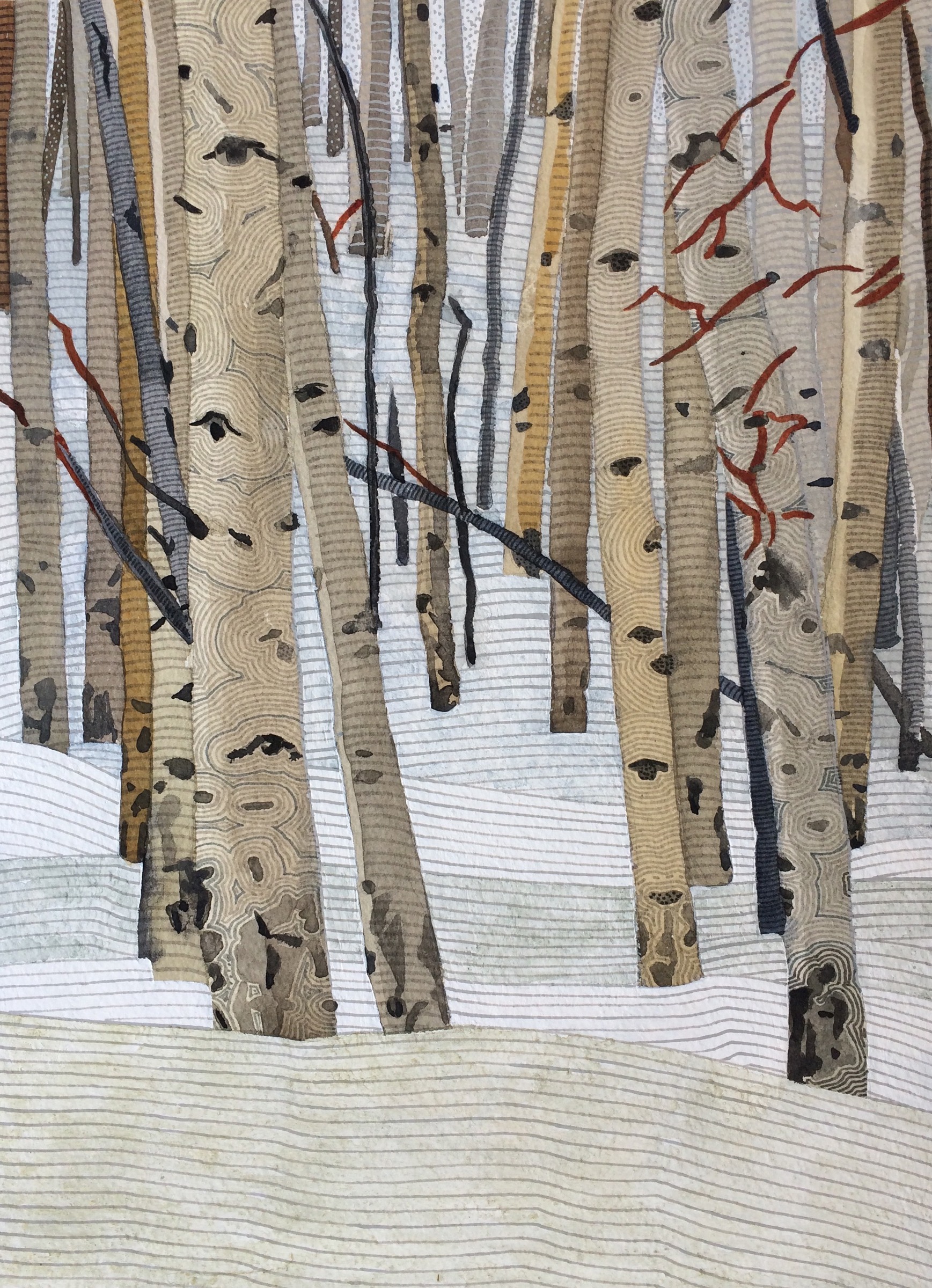
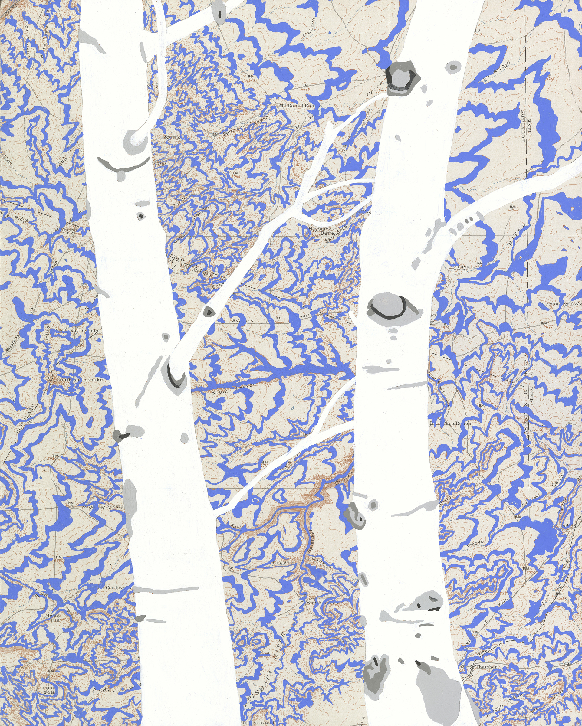
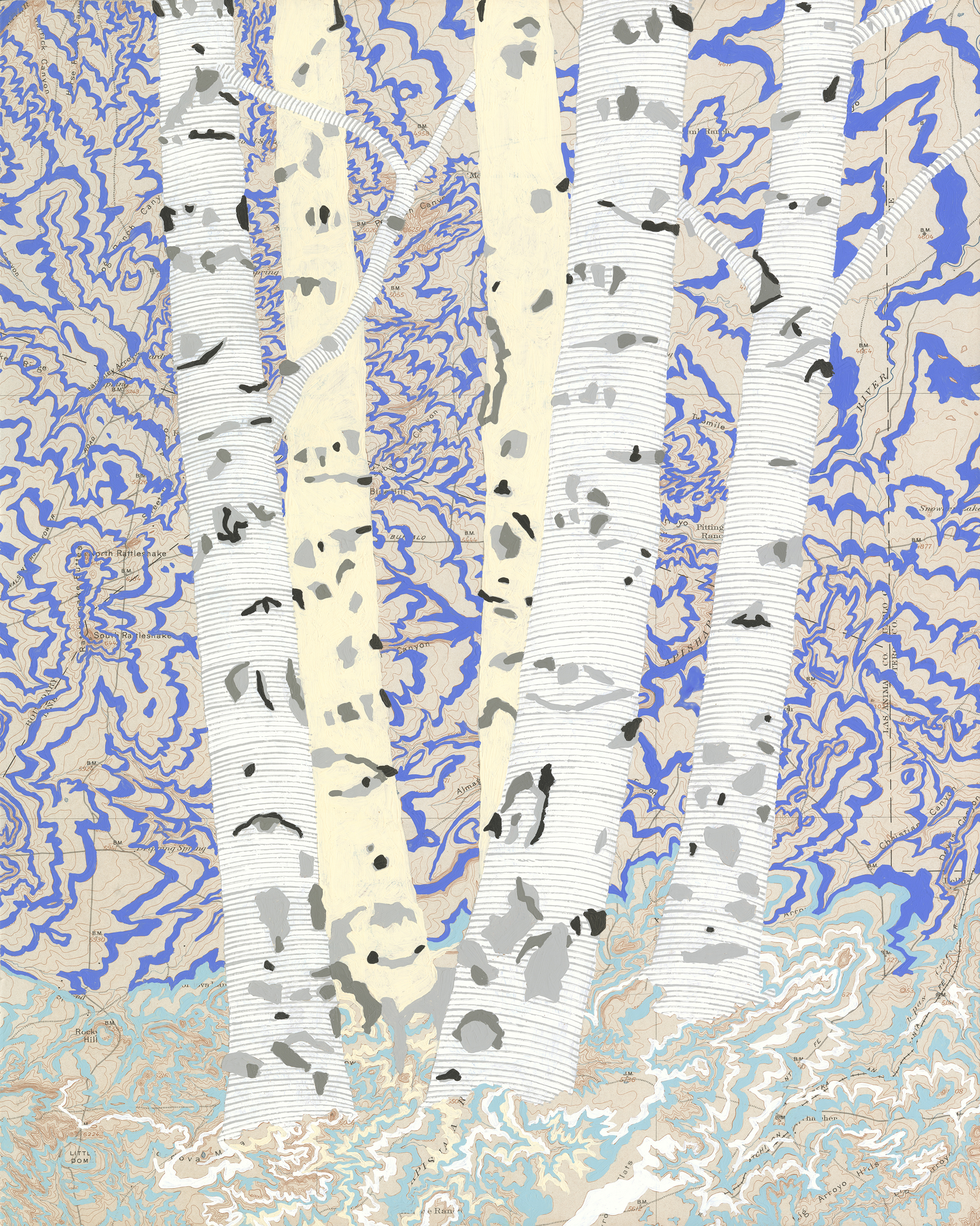
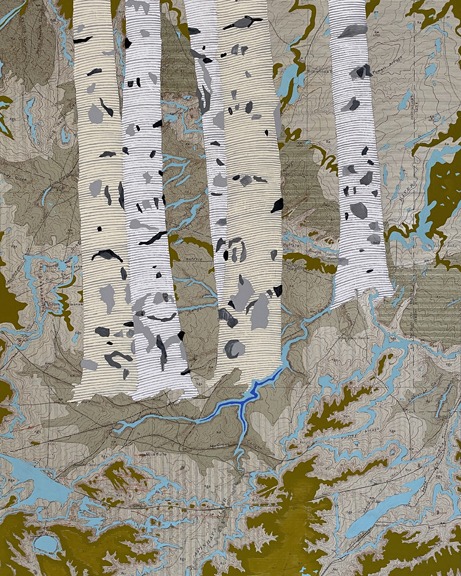
As the Covid19 pandemic continued into the winter of 2020/2021 I started to paint a multitude of rivers in all of the washes, gullies, arroyos, and canyons on the topographic maps. This visual representation was meant to be akin to a Native American rain dance ceremony, a weather-modification ritual that attempts to invoke rain. Rivers Feed the  Trees was my response to the thought of another impending drought and is my visual representation of the Rain Dance which is most often performed by the Pueblo, Navajo,  Hopi and Mojave tribes, all of whom live in the southwestern United States. In the San Juan Mountains, I wanted to invoke a significant winter and spring snowfall resulting in an abundant runoff to nourish the earth for the coming summer. This more precise way of painting kept me grounded as we moved through more uncertain times.  

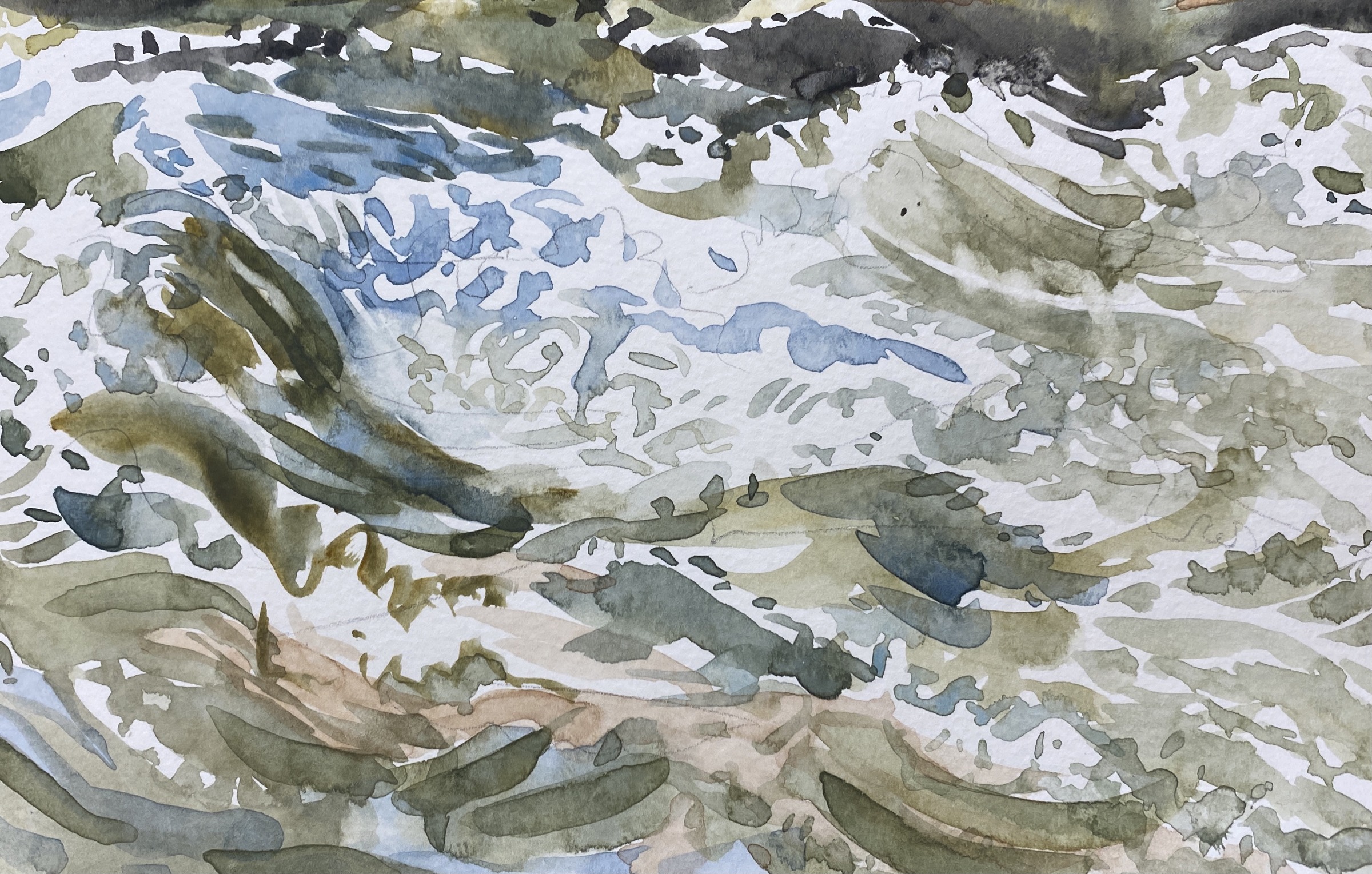
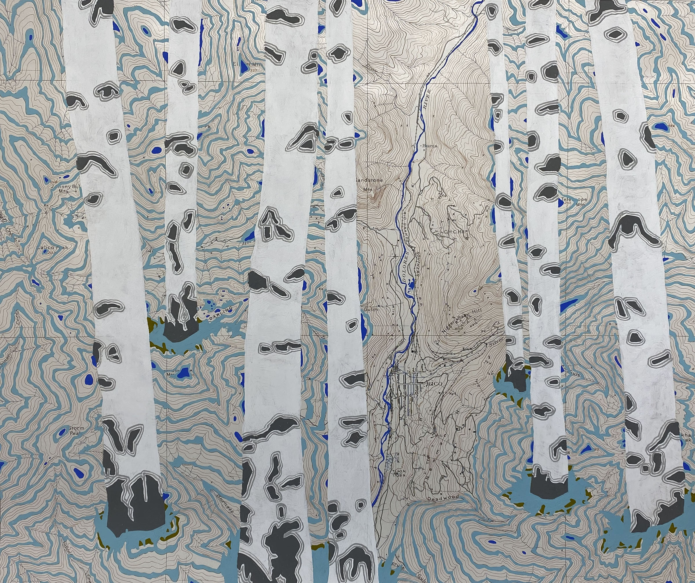
In the spring I walked down to the river and painted the runoff. I wanted to capture, in real-time, the energy of the spring snowmelt filling the rivers and rushing downstream. 

Rivers Feed The Trees #456, 2021, Acrylagouache On Historic Topographic Map, 13.5” X 17”

The energy in the landscape is the thing I have always tried to capture in my paintings.  My students say that once they have started painting and drawing the landscape in terms of what it is doing rather than what it looks like they experience it in an entirely new way. They feel more connected to and hyperaware of their environment as they walk through a world that is now moving along with them. I believe in the power of observational drawing to change the way one looks at the world. I also believe in the power of the visual image to communicate a personal narrative and point of view that can resonate with another. 

Rivers Feed The Trees #470, 2021, Acrylagouache On Historic Topographic Map, 13.5” X 17”

I want my on-site paintings to shine a light on every aspect of our environment. With specific series like RIVERS FEED THE TREES and BLOWDOWN, which depicts the mycorrhizal network beneath the forest floor,  

I hope that the images will inspire a thoughtful engagement with certain aspects of the natural world. 

Meredith Nemirov is from NYC. She studied at The Art Students League and received a BFA from  Parson’s School of Design. After working as a freelance illustrator for 11 years she devoted her time to painting and exhibiting her work. 

In 1988 she moved to Ridgway, CO, and opened the Ridgway Gallery which specialized in antique prints, maps, and books about the exploration of the American West.  

The gallery closed in 1999 and since then has focused on her studio work, on-site painting, and teaching. 

She maintains a studio in Ridgway and part-time in Spain where she teaches each year on the island of Mallorca.  

website: meredithnemirov.com 
Instagram: @meredith.nemirov 
Facebook: Meredith Nemirov
email: meredith.nemirov@gmail.com 

This article is part of the MAHB Arts Community‘s “More About the Arts and the Anthropocene”. If you are an artist interested in sharing your thoughts and artwork, as it relates to the topic, please send a message to Michele Guieu, Eco-Artist and MAHB Arts Community coordinator: michele@mahbonline.org.
Thank you. ~

The views and opinions expressed through the MAHB Website are those of the contributing authors and do not necessarily reflect an official position of the MAHB. The MAHB aims to share a range of perspectives and welcomes the discussions that they prompt.